Kettle Valley: Chute Lake – What a Road!

This is the last of 3 blogs concerning my 2017 riding of the Kettle Valley. The good intentions were to hub and spoke out of Penticton and complete three rides: 1) Osoyoos North to Penticton; 2) Skaha Lake 3) Chute Lake to Penticton.

What Road!

The road up to Chute Lake was impressive. At times a 12% grade with numerous switch backs on a sandy gravel surface. It was challenging enough in dry weather I could only imagine the climb after a recent rain or snow fall.  Slick as snot comes to mind (to use a technical term).

The road deposits you at the Chute Lake Resort and the lake itself. The KVR passes the lake from a point further east and our original put-in, Myra Lake. Had we started from Myra, the distance would have been 80KM.  A bit out of reach for a first ride of the area so Chute Lake was a reasonable compromise.

Mileage Signs en route.

Sand Bogs and a Closed Tunnel

The first 5KM or so of the ride was mush. Mush in this context means sandy soil that quickly absorbed one’s tires and made it nearly impossible to ride. In some places a raised shoulder provided enough terra firma to allow for some speed but often this effort was absorbed with a return to the mushy middle of the trail. Lower air pressure likely could have compensated and I suspect a good fat bike tire would have glided over this section of trail with barely a whimper or note of the mush underneath.

After this initial section, the trail began to harden to a more uniform gravel bed that was generally fine to ride on.  Given the altitude gained on the road up to the put-in, vistas were available aplenty. One portion of the trail that was closed was a U-shaped Adra tunnel.

Currently barricaded, the tunnel is about 500M long and takes a north/south orientated track to an east/west exit/entrance. Appeals for donations are made for the tunnel’s restoration which would be great. In the mean time a steep descent provides a cut off for the tunnel. A fun ride down, it would be a hard ride/push up! Coming from descent side of the tunnel, the temperature appreciably drops at 10C in the gloom of its entrance.

In front of the closed Adra tunnel.

Ride Into Penticton

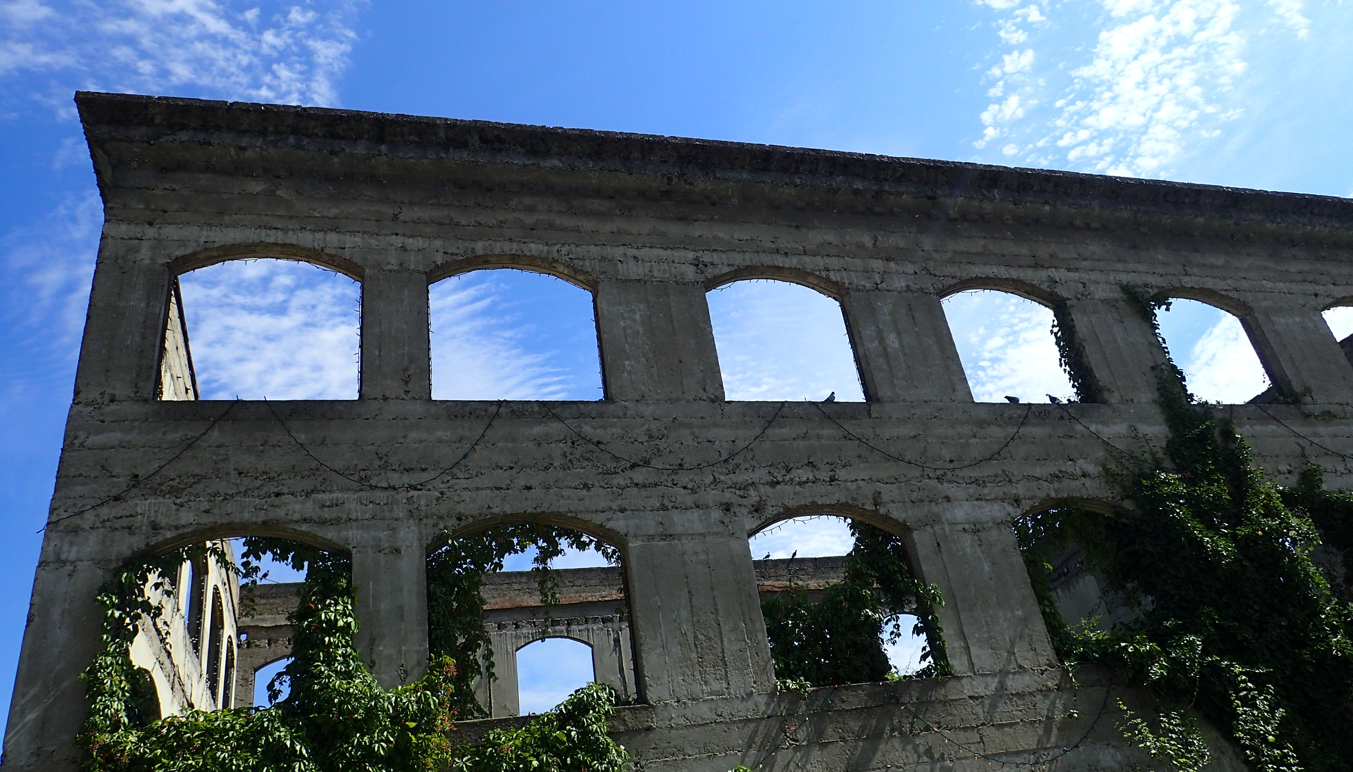
From the tunnel, the ride is a gentle descent past numerous historical markers including a number of rock ovens used to bake bread during the KVR’s construction. Other markers include the foundation for a long-since dismantled water tower, a larger Ponderosa Pine and things of that ilk.

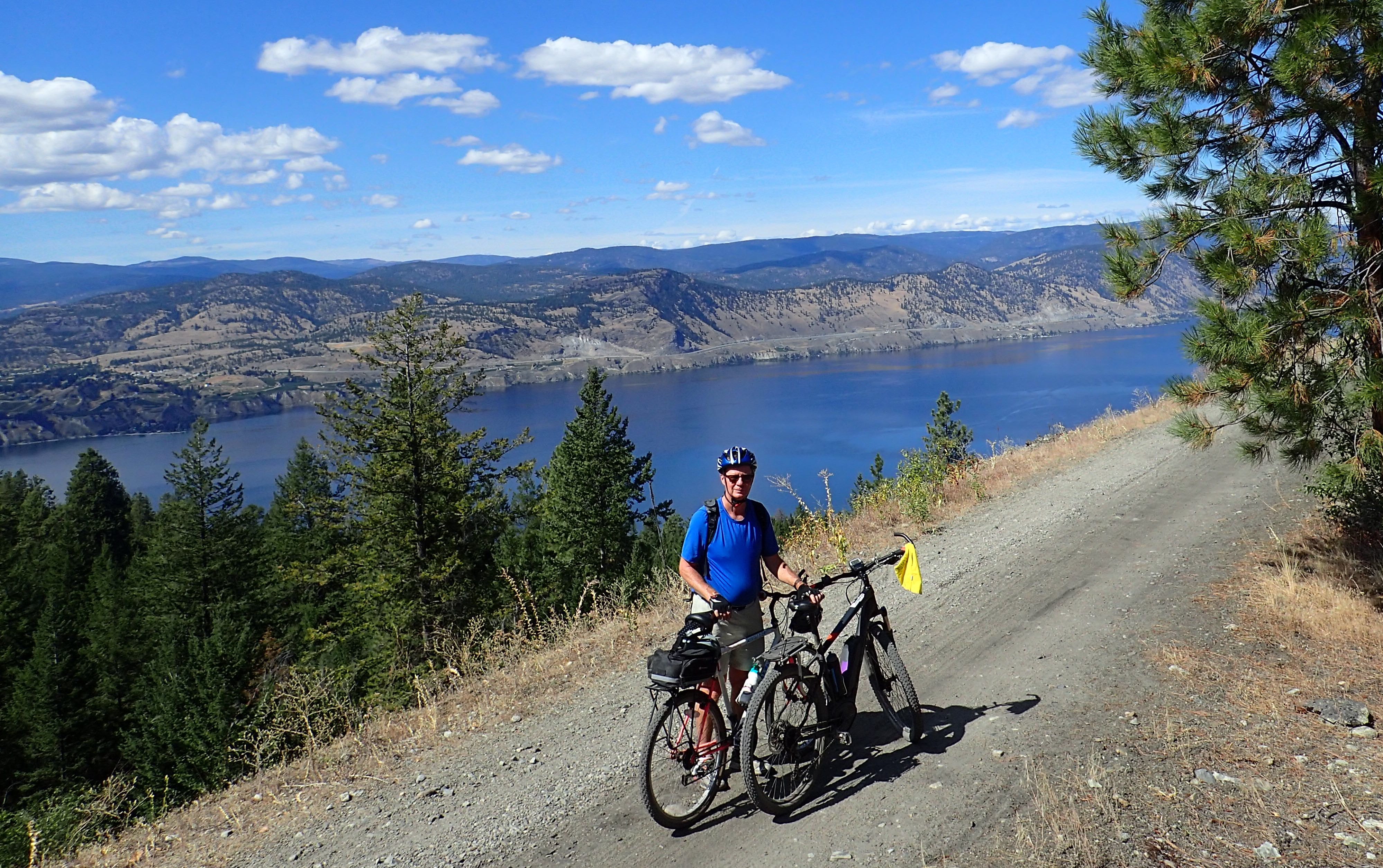
One of the great vistas with Summer Land across Okanagan Lake.

Conclusion

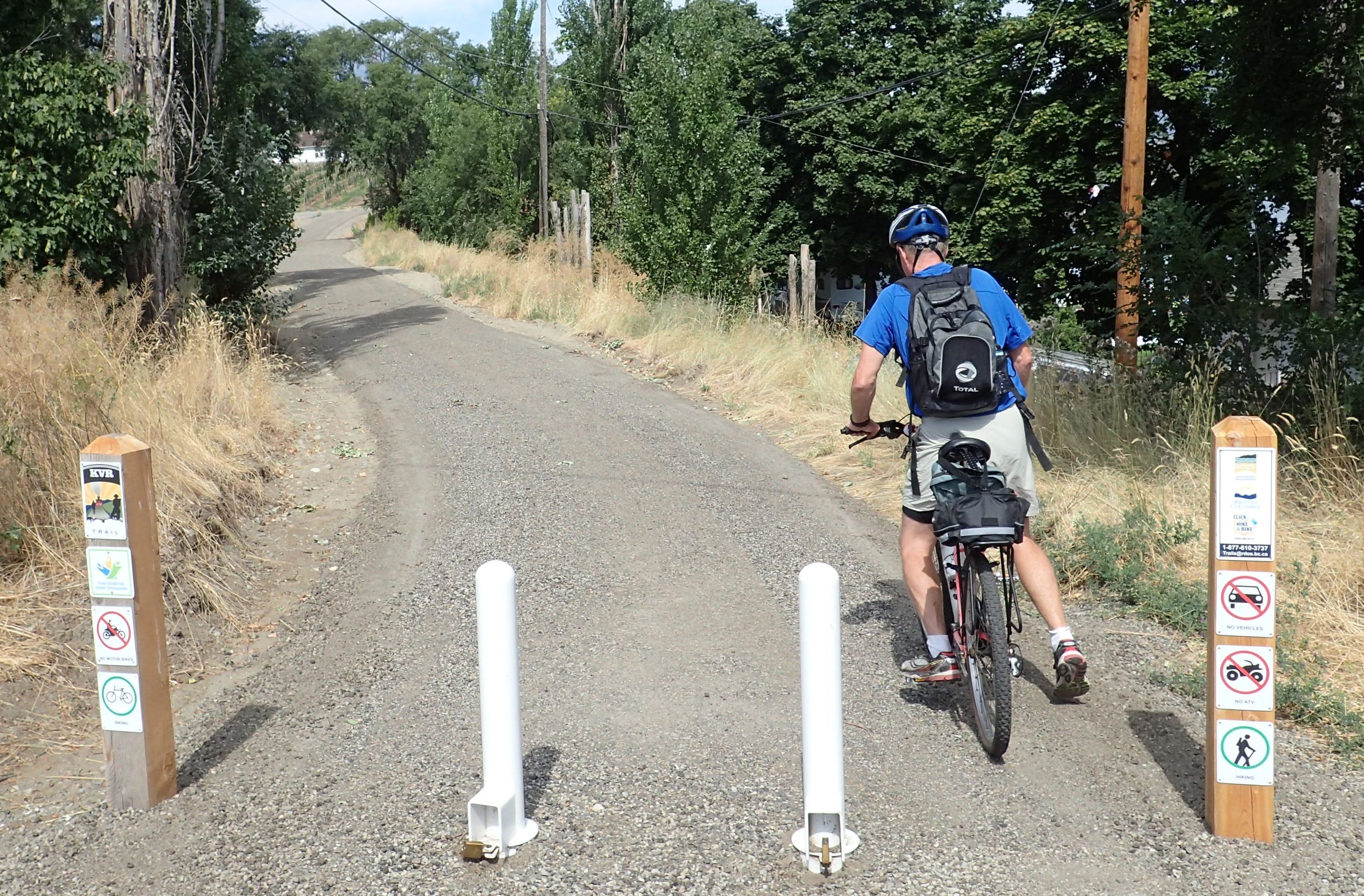
Our transport picked us up still high above Penticton. The trail however continues down into the city along the KVR route and as well along a city constructed trail. Finding the trail required a small bit of route finding as one section would end and the next would start-up to half a block away. A disappeared trail general meant a scan up and down the road to see where the city put the next piece.

Overall, this is a great section of trail. The ride from Myra Lake to Penticton is very doable on a good mountain/fat bike. Likely this would be an all day affair particularly with a car shuttle. Given the remoteness of the initial section, an available support vehicle would be a strongly desirable additional feature. In other words, Penticton KVR – I will be back!

Kettle Valley: Skaha Lake Loop – Ice Cream Detour

This is the second of a set of 3 blogs concerning my 2017 riding of the Kettle Valley. The good intentions were to hub and spoke out of Penticton and complete three rides: 1) Osoyoos North to Penticton; 2) Skaha Lake 3) Chute Lake to Penticton.

Skaha – Consolation Prize

Unfortunately my partner in riding had an unanticipated work commitment and the planned ride could not occur. Nevertheless, the ride we did was a perfect little putz with a too large ice cream in the middle.

Skaha Lake is just south of Penticton and like most of Okanagan lakes is narrow and long. Smaller than most lakes, it is 11.8km long and book ended by Penticton to the North and Okanagan Falls to the south. This ride took us from our motel at the north end of Skaha south along the west side of the lake to Okanagan Falls.

Although the trail was empty when I rode it the previously day, on this day there were about a dozen cyclists and walkers using the trail. The trail itself deposits you at the beach in Okanagan Falls and from this location the logical thing is to look for ice cream.

Vista Skaha Lake from the west side.

This is a Children’s Cone?

On the south side of the town is an ice cream institution, Tickleberries. A combination of ice cream gift and junk shop, they are known for their generous portions so I thought I would be smart by ordering a childrens cone. Apparently in the Okanagan, children are capable of eating two fist size scopes of ice cream! Either they are very tough or have a morbid obesity problem.

Return Along the East Side

Like most large lakes in British Columbia, there is a distinct East and West side (mostly because the mountain ranges generally in BC run North/South). Our return was along the East road and generally it was uneventful and occasionally pulled the user up into a mid-level vista of the lake. Good asphalt and a reasonable shoulder. We took a short detour back into Penticton to find a cold beer and then rode out to the hotel.

Conclusion

A nice albeit short ride of about 30km with moderate undulations in climbs and descents. Suitable for an older child reasonably comfortable on a bike. This could be a tune up and a first day ride if just arriving in the area. The one factor is the amount of fine grit and sand on the west side which tends to cover the bike and running gear. Like other trails in the KVR, a good chain cleaner is a must post ride!

One of the many historical and natural sites along the route.

Kettle Valley Osoyoos to Penticton – NOT

This is the first of a set of 3 blogs concerning my 2017 riding of the Kettle Valley. The good intentions were to hub and spoke out of Penticton and complete three rides: 1) Osoyoos North to Penticton; 2) Skaha Lake 3) Chute Lake to Penticton.

These rides were based on the trail guide: Cycling the Kettle Valley Railway, by Dan Langford.  Generally a well written and descriptive book, in this section alas it failed miserably.  Not to put too fine of a point on it but there is NOT a contiguous trail North from Osoyoos to Penticton.  The trail guide is not the only source that suggests that there is such a route, the provincial maps also clearly show such a trail.  Certainly poking around north Osoyoos failed to yield much evidence.  However, if you don’t mind a bit of highway riding and some flat and boring trails, you can get North to Penticton.

Note: this is a potential source of future reference, Trails BC.

North of the 49th

We started our ride at the border crossing just south of Osoyoos.  Still in Canadian territory, the ride went north along Highwya 97 to Osoyoos town limits.  From the park in the town, a trail winds it way North until private land and signs indicating no trespassing stop you at this point.  Apparently the land on which this spur of the railway was sold in the 1970’s and there is no longer a legitmate public access route.  As well, there is some hostility amongst landowners against a trail being created due to concerns of vandalism, etc.

Back to Highway 97

From the end of the trail, we re-climbed out of the valley to highway 97.  While the road is ‘okay’ (reasonable shoulder, moderate to heavy traffic), it certainly is not ideal. In the end we cut east again along Road 22.  Mentioned a few times, this road was also ‘okay’.  It had its share of undulations and the hill climbs gave a moderate cardio work out.  The alternative was to ride along the river/irrigation canal that runs from Skaha Lake to the North and Osoyoos Lake to the south.

Road 22 to Oliver

Road 22 eventually descends into the town of Oliver where we had a spot of lunch in the park.  From there, the trail along the river continues on until it intersects Highway 97.  Once again, the maps suggest that it continues west of the highway but we could find no sign of the trail.  Instead the route was along highway 97 to Okanagan Falls.  From here there is an excellent trail on the west side of Skaha lake that will take you into south Penticton.  Along this route I had the following black bear experience:

On a remote section a black bear Cub popped onto the trail. The problem with a bear club 100m ahead of you is where is it’s the mother. Fortunately she popped up beside the cub. She took a look at me and decided I was not worth the bother and ambled off to the other side of the trail with cub on tow. At this point, 15 seconds later I was glad I was uninteresting… Alas no photo but at least I got to tell the tale!

Conclusion

It might be interesting to go back and try to find a route from Osoyoos to Penticton… okay, not fantastically high on the priority list of trips to do in the time remaining here on earth, but if circumstandes allow for it, interesting nevertheless.

Starting on one of the intermittent sections of the Osoyoos to Penticton KVR.