Back to Northwest Quadrant – YEG-Ville.
For current information on this site, please visit the Stewards of Alberta’s Protected Areas Association: Lily Lake Natural Area | SAPAA (sapaastewards.com).
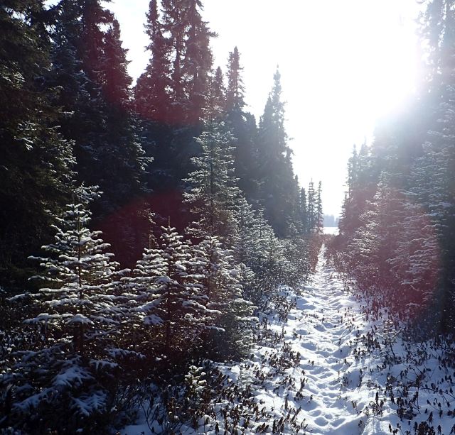
This ~425 acre natural area occupies the North, East and Southern portions of Lily Lake. It is largely free of ATV ruts despite two distinct cut lines starting at Township Road 550 and heading South to the Lake. Kudos to the Alberta Beach Snowmobile Club for resisting the temptation to quad or snowmobile along these routes. There is little foot traffic evident and the few trails follow a fence and burst onto a cute little prairie lake. The site is relatively pristine and remote. As a result there are no facilities in the area (washrooms, etc.).
The Fast Facts
- ADVENTURE.
- Worth Visiting due to low traffic.
- No Washrooms.
- Not Kid Focused
- High Beginner due to remoteness and lack of trails.
The area has a rolling topography with numerous wet depressions; mixed forests of aspen-balsam poplar-white spruce; willow shrublands; black spruce & tamarack/Labrador tea-dwarf birch wetlands [1]. There are not a lot of trails per se which is the attraction for Lily Lake. You follow a cut line down to the lake and then follow deer or old cut lines to go exploring. This is the reason for the rating of High Beginner. Please note that the western half of the lake is private land.
Does a Lily Smell as Sweet by Any Other Name?
The origin of the name is unknown, but presumed to be a reference to water lilies (Nymphaea odorata) on the surface. The name was documented in the 1887 field notes of the Dominion Land Survey and started to appear on Department of the Interior maps by 1917 [2]. Unfortunately, no lilies in the winter. Nevertheless, an excellent location to practice more remote snowshoeing – not too far off the beaten path.
- Name/Owner: Lily Lake Natural Area
- Is it Worth It and Why Go Here?: Worth going to enjoy an relatively pristine natural area.
- Map Reference, Location and WGU:
- Central Alberta Backroads Map Book, p. Wabamun Lake (p. 44), Cell B3.
- 53′ 43″ -114′ 40″; head west (see Drive Out notes below) and connect to Highway 765. From there, head West on Township Road 550. Access is from the North on 550, you will walk south towards the lake.
- Wayne Gretzky Driving Time & Distance: 1 hour(s) 8 Min(s) & 96 Kilometers
- Difficulty Level & Safety: High Beginner due to remoteness, lack of trails and need to navigate through the forest.
- Comments
- Links: See Notes and References and the Government of Alberta Website.
- The Drive Out: You quickly leave the estate community profusion and enter into rural Alberta. Instead of taking Highway 16, consider taking the less travelled East-West highways such as 37 or 633 to get to your destination.
- The Other Shoe: Fat biking, walking.
- Kid Rating: Nothing specific for kids other than seeing a bit of Alberta wilderness and listen to the silence for a bit.
- Frank’s Trip Notes: First done: 2020-12-16.
Notes and Reference
- Kelland, Roland. “Potter Asks – Origin of Alberta Place Names West of Edmonton and North of Hwy 16,” December 21, 2020.
- Protected Areas Information. “Stewards of Alberta’s Protected Areas Association (SAPAA).” Accessed December 10, 2020. http://sapaastewards.com/index.html.
