Is Nonprofit Incorporation Worth the Bother?

A new cycling club is asking, is incorporation really necessary? Spoiler alert, it is as it offers liability protection, clarity, and credibility even thought no one likes to volunteer to fill in government paperwork.

Continue reading

The Bus Chronicles

New Year’s resolutions are dangerous affairs, so dangerous that most people quickly abandon them for the familiar arms of bad habits. It is with this in mind that I am sharing my resolution: I no longer plan to drive to work.  Dear boss, don’t worry, I am planning on coming to work just that I don’t plan to drive there.

The Motivations on the Bus Go Round and Round …

There are of course a number of reasons to not drive:

  1. Concern about climate change and reducing your carbon foot print;
  2. Unable to drive for reasons beyond one’s control (blindness, illness)
  3. Unable to drive for reasons in your control due to poor choices (drunk driving, loss of a license)
  4. Trying to save money. 
  5. Other reasons.

I am comfortable enough with my parsimonious-ality to let you know my motivation is a combination of numbers #4 and #5. As for the other reasons (#1), I doubt my little Ford Ranger will make that much of a difference to climate change as compared to the 259 NEW GW of coal-fired generation plants China is bring online.  Fortunately I am both capable and legally allowed to drive (#2 and #3).  Besides, like the vast majority of people, I am an above average driver!

Transit Snobbery 

Having just come back from Vienna with a world class transit system, I will be using a system that is definitely middle of the road.  Not chickens in cages seated next to me but definitely not at the Western European standard either.  My son swore off the bus when going to University with horror stories of them blowing past waiting passengers at bus stops, arriving late, excessively early and surly drivers.  Hopefully my adventures are more pleasant.  

U2 U-Bahn (metro) crossing the Danube heading into Vienna City Center

The Economics of the Bus

 But back to my motivations and the first is economics and while the cash flow is positive it is not great, here is how driving versus the bus stacks up:

Factor Driving Bus
Bus Pass per Month 116.00
Gas Costs*/Month 130.00
Parking Pass**/Month 126.15
Insurance/Maintenance $$$
Total Cost 246.15 116.00
Cost per Work Day$$ 12.30 5.80
Driving time # 30-45 minutes/day 60-90 minutes/day
  • * I get about 7km/litre and have a ~45km commute per day.  Assuming $1.00 per litre (currently gas is as $0.90) this works out to $115 – $120/day.
  • ** Technically I don’t pay for parking but I am charged a taxable benefit of $145/bi-weekly.  Assuming a 40% marginal tax rate this results in a cash cost of $126.15/month.
  • # These are highly variable, I have gotten to work on a quiet Sunday in 20 minutes and other times it has taken me 2 hours to get home due to the weather.  Overall though, I suspect that the impact on time will be a bit of a wash of driving over transit.
  • $$$ I haven’t calculated this yet, see failing fast below before I change my insurance.

Assuming 20 work days per month ($$), the difference in cost is about $6.50/day or about $130.00 per month or perhaps a grand a year.  Mehhh, not really big enough money to be spending 100% more time in my commute, so why would anyone want to give up a comfy(ish) Ford Ranger for a bus?

Reading, Riding and A-Rhythmic-Meditation

My motivation is the 3.2km walk from my house to the bus depot.  3,200 metres in the morning is about 3,000 steps (of a suggested 10,000 per day total) and 40 minutes in walking meditation.  Once on the bus , I plan to read.  While I can listen to books in my vehicle, taking notes while driving is not recommended.  There is also something peaceful about letting someone else worry about the stop and go of traffic while you either read or stare into middle space.  Finally, the most important reason involves a bike. 

I hope to bike commute more this year.  Not having a parking pass is like burning my boats; there is no going back!  Okay, I can pay for expensive day parking but that metaphor is not nearly as good as smoldering boats.  

Wish Me Luck and Failing Fast

So that is my new year’s resolution and given that I just dropped $116 on a pass to get started.  If I can get through January, then February should be easier, etc..  Wish me luck and if not, see you on the road in February.   

FeCT – 2018-08-12 a Ride Too Far

The is the third leg of riding about 500km of the Iron Curtain Trail or FeCT.

A Ride too Far Austria/Czech/Hungry – (60km)

Date: August 12, 2018
Starting Point (via): Marchegg Bahnhof
Weather Sunny, warm to hot and moderate to moderate north becoming south winds.
Route: 
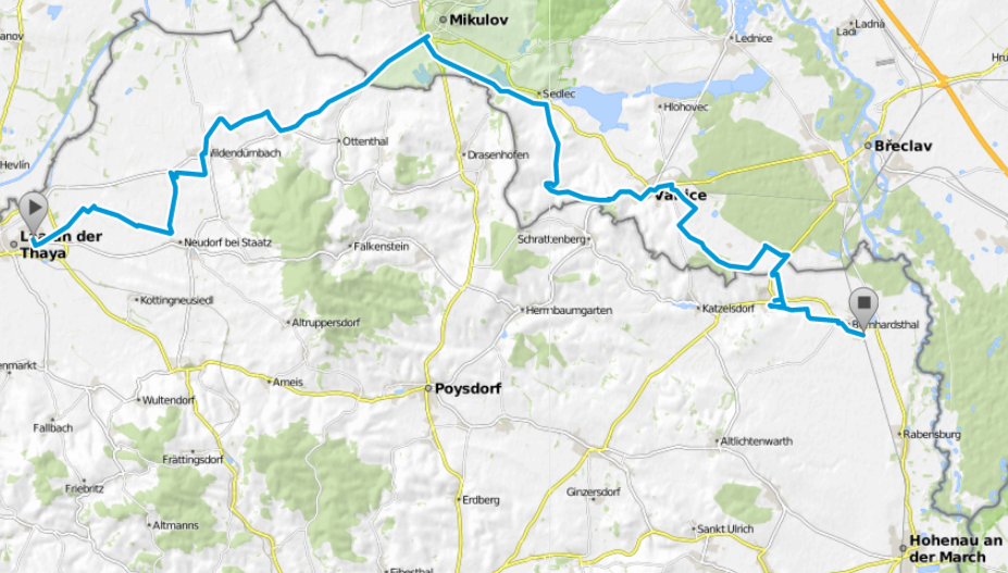
South from Marchegg picking up the FeCT.  Through Bratislava and exiting the trail at Mönchhof (98km total ride, 78km without re-traces and 72 km FeCT riding).

This was supposed to be a simple ride.  We picked up the trail where I had left it a few weeks ago, through Bratislava and zig zags down to a convenient railway station allowing for a good ride pick up later on… that was the plan.  Instead it became a comedy of errors of route finding, construction detours, poor signage, a bit of bushwhacking, missed trains and some generous albeit drunk Austrians.  All in all a good day.

Bratislava – Where the F*CK is the Trail

I picked up the trail after a short 6km leg from Marchegg to the Friendship bridge.The route was good all the way into Bratislava.  Some of the walking trails showing their age being overgrown or somewhat broken.  As a warning Iron Curtain Trail signage in Bratislava is at best spotty, is hopefully not missing and at worst confusing and contradictory.

Getting to the first bridge that crossed the Danube presented our first mystery relating to signage.  The route involved going far back toward the bridge proper and take a ramp up to the pedestrian walks below the deck and on the sides of the bridge.  Clear signage to get you through a dark parking lot, nope.  Maybe a few clues spray painted on the pavement, nope.  And thus our first route finding fiasco had us trying to get up to the car deck where we discovered not pedestrian access.

Once across the bridge, the routing out of Bratislava consisted of a single sign directing us with vague ‘somewhere in that general direction’ accuracy.  Needless to say, bring a VERY good map to Bratislava, take it VERY slow and watch carefully and either a GPS or a Slovak enable smart phone are good additions as well.

Okay Signage and a Shark Tooth Border

The Hungarian/Austrian/Slovak borders south of Bratislava are a series of jagged saw tooth projections into each others territories.  Given that this border was heavily fortified, it must have taken enormous manpower given the elongations the border contours would have caused – which of course is exactly why the Hungarians opened the border because they could not afford to fix the then aging infrastructure.

Once again signage is okay to non-existence so be prepared to do a bit of route finding along the way.  Say hello to the occasional Austrian soldier who is keeping vigil because of the recent waves of migration from the eastern countries.  Of course one of the joys of route finding is being completely off the grid.  That happened in one leg when we ended up ‘bush whacking’ over a fairly overgrown trail and then enjoyed a few km of gravel roads until we could pick up a hard top surface riding into our final destination, Mönchhof.

A Missed Train and Friendly Austrians

From Mönchhof we thought we would enjoy a beer and meal in Neusiedler See (lake).  Alas we got off at the wrong station which may be just as well as there does not seem to be much in the way of services.  Nevertheless found cold beer and a passable Chinese supper at another train station.  As we were leaving, some nearby Austrians invited us for a drink –  a nice hospitable gesture – that caused us to miss our train by about 30 seconds.  Little did we know that next train just happened to be not an hour later but a full two hours later.

So, an eventful ride that was about 20km longer than intended marked by lots of route finding, generous invitations, missing signs and a very strange train schedule!

60km of the FeCT. Map courtesy of bikemap.net.

Route map (purged of all the bits where we circled around lost).
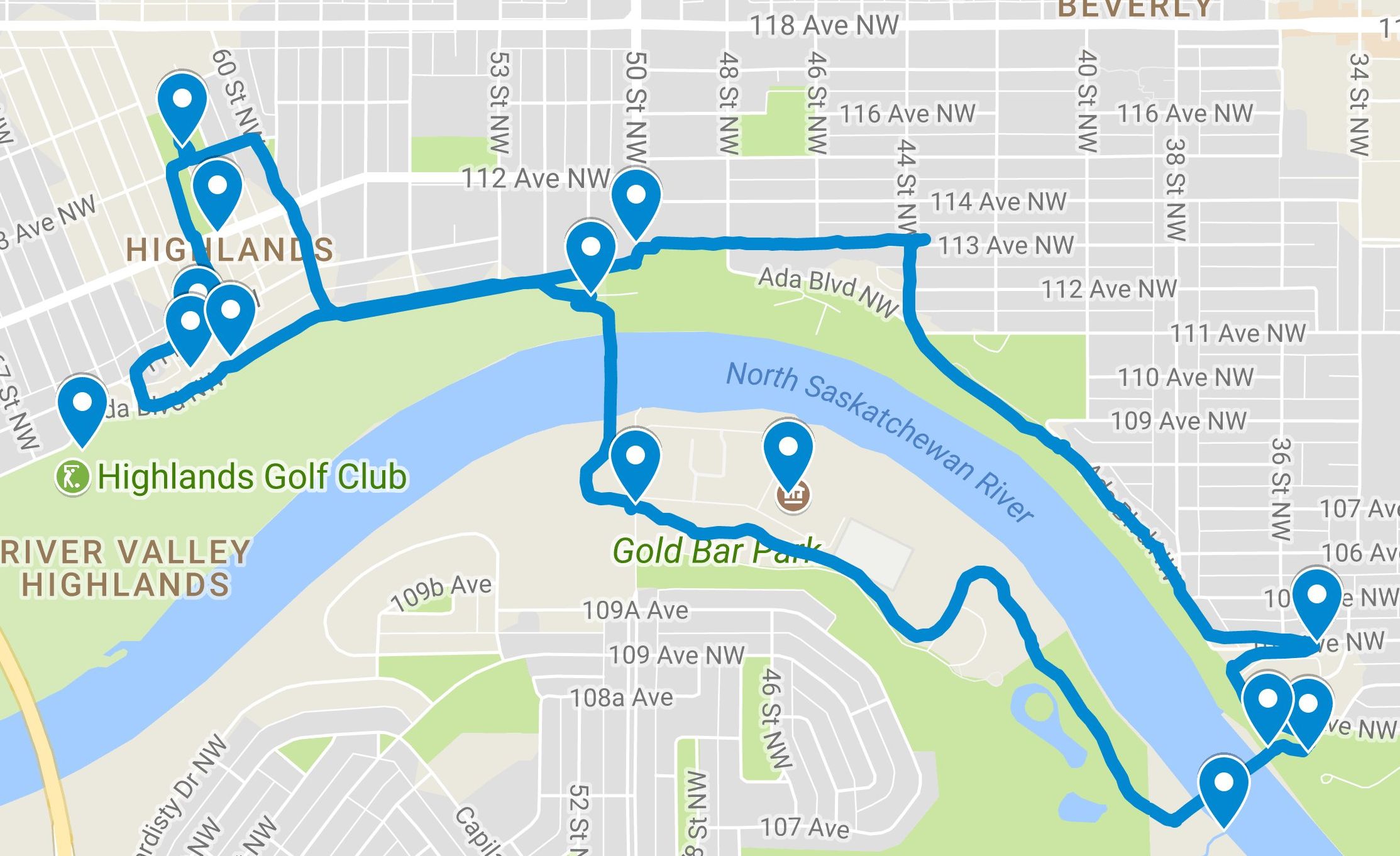
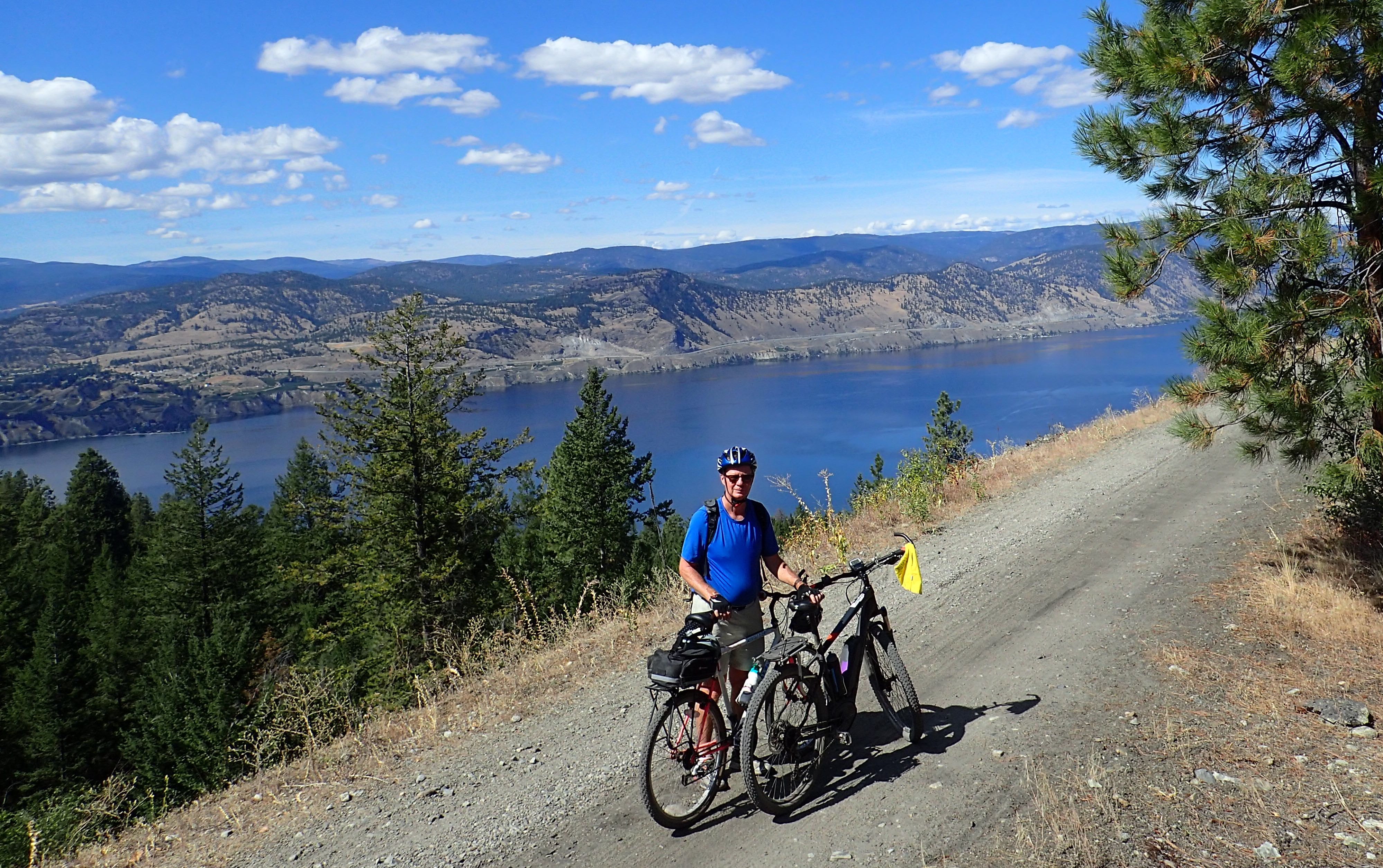
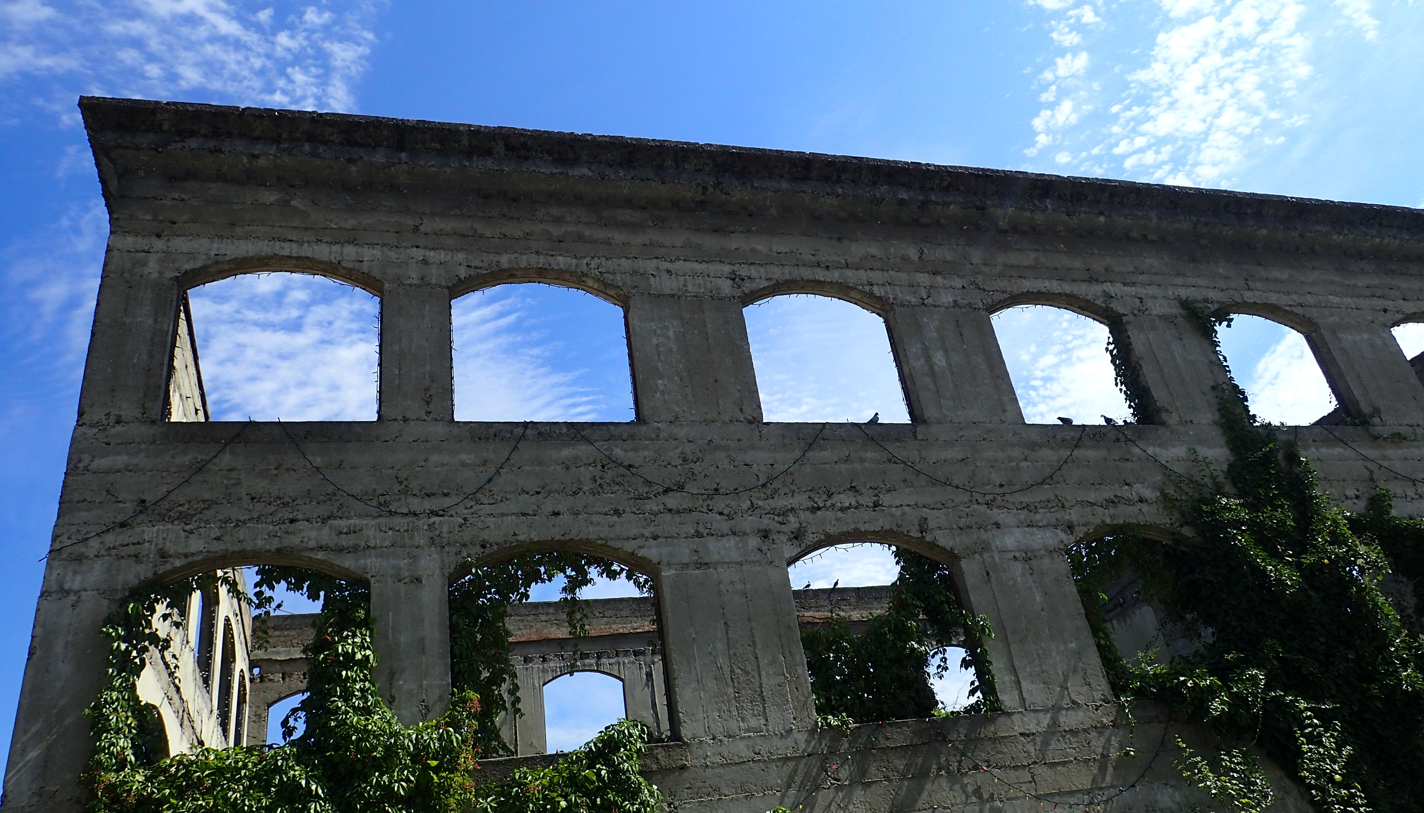
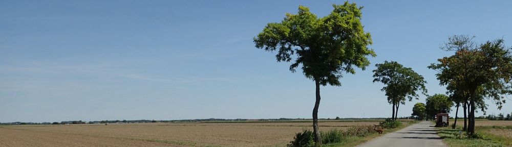
A Few Pics

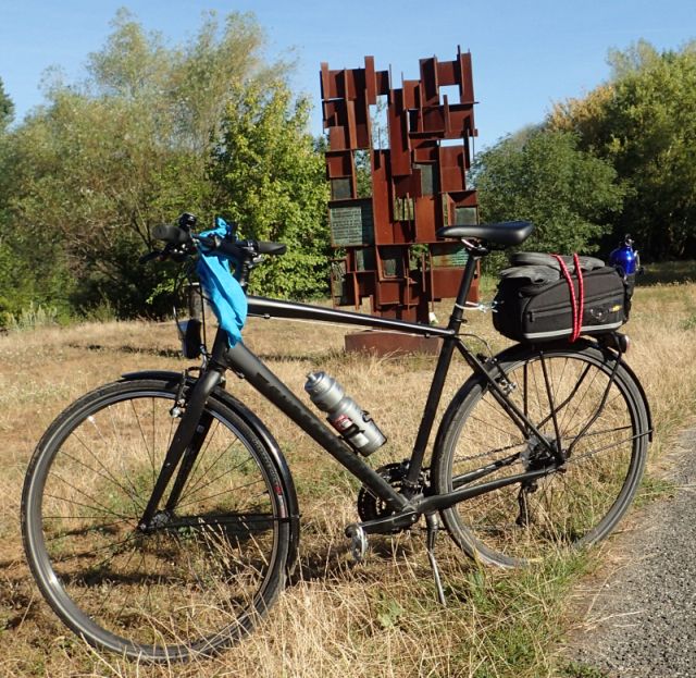
The trusty steed at the Devin memorial

These guys were feeding bread crumbs to the Carp in the water. Those are not rapids but were instead a few hundred large carp fighting for the food.

The Sea can in the distance where for the soldiers monitoring this remote out post. Note the deer just to the left of the road.

Tri-corner where Austria, Slovakia and Hungry meet. I was Austrian and Gift (right) was feeling a bit more Hungari(an)

The Score!

Date Distance Name Impressions/Comments
2018-07-15 66 km Retz to Laa A great section with lots of things to see.
2018-08-05 60km Laa to Hohenau (almost) Rolling hills, lots of rural-ness.
2018-08-14 10 km Bernhardsthal to Hohenau am March A stub ride to finish the gap.
2018-07-15 52.7 km Hohenau to Friendship Bridge Green and very flat; accessible from Vienna.
2018-08-12 72 Friendship Bridge to Mönchhof Bring a good map and plan to route find!


FeCT – 2018-08-05 – Too Much Heat

The is the second leg of riding about 500km of the Iron Curtain Trail or FeCT.

Too Much Heat in Rural Austria/Czech – Laa (60km)

Date: August 5, 2018
Starting Point (via): Laa Bahnhof
Weather Sunny, hot and moderate to strong NW winds.
Route: East from Laa with a small North jog into the Czech Republic (52km and all FeCT riding).

This was a fill in section and unfortunately I have small gap of about 10km. Alas the 35C temperatures and not wanting to miss a train both depleted me and forced the decision. As for the section, not bad. I would take the Austrian section between Retz and Laa over this bit but this is nitpicking.

The tour was was rural Austria/Czech at its best. Through in a few castles, ancient churches and you have yourself a great ride. Mostly on ashpalt but enough rough pavement and gravel to make you want to leave your pricey road bike at home. In fact a soft tail or shocks would have been good for these sections.

The route itself was through rolling hills and there was some good sections about the history of the Iron Curtain… with the catch that you have to be able to read Czech. The Czech side seemed a bit more developed than the section from Retz to Laa and there were lots of locals on their bikes with kids and large groups.

As for the Iron Curtain, it has largely disappeared other than the memorials and the occasional machine gun emplacement. This of course is a good thing and the whole point of this trail…

60km of the FeCT. Map courtesy of bikemap.net.

Laa to Hohenau (almost)

A Few Pics

Wien Kellers

Heading North into the town of Mikulov

The Score!

Date Distance Name Impressions/Comments
2018-07-15 66 km Retz to Laa A great section with lots of things to see.
2018-08-05 60km Laa to Hohenau (almost) Rolling hills, lots of rural-ness.
2018-07-15 52.7 km Hohenau to Friendship Bridge Green and very flat; accessible from Vienna.
2018-08-12 10 km Bernhardsthal to Hohenau am March A stub ride to finish the gap.


2017-12-03 EBTC Highlands-Beverly Walking Tour

These are some notes from a December 3, 2017 historical walk I did for the Edmonton Bicycle and Touring Club.  This was a combination of a stroll, historical and social notes.  See my sources below if you want to read more.

Context: The Area pre-1914

  • The area was annexed by Edmonton in 1912, and “was named in a contest offering a 50-dollar Gold Bar.” [1]
  • The neighbourhood is bounded on the north by 118 (Alberta) Avenue, on the east by 50 Street, on the west by 67 Street, and on the south by the North Saskatchewan River valley. [2]
  • The community is represented by the Highlands Community League, established in 1921. [2]

The Walk

Points of interest and route

  • 01) Start: Highlands Community Centre, 6112-113 Avenue, Edmonton.
    • What was the area like at different epochs: 10,000 years ago, pre-Hudson Bay Company, HBC era and then in 1900.
  • 02) South to 112 Avenue; be careful crossing 112th street, look both ways for street cars… the last one ran in 1951 but they could start-up any time! [3]  The end of the line was at 112 Avenue x 61 Street [4].
    • The development of the area was predicated on a street trolley being built.
  • 03) Walk to 6229 111 Ave NW; the Carriage House; this is where they stored the carriages! [1, pp. 267-269].
  • 04) Walk to 6240 Ada Blvd; this is the mansion for Magrath, one of the two developers [1, pp. 257-259].
    • Lived with his wife Ada… notice a connection?
    • And their son Adrian.
  • 05) Walk to 6210 Ada Blvd NW, Holgate Mansion [1, pp. 259-260].
  • Walk along Ada Blvd East towards 50th Street.
  • 06) 50th Street, start of the Beverly Heights Neighbourhood.
    • Originally part of the Town of Beverly, amalgamated with Edmonton 1961. [5]
    • Edmonton assumed the town’s debt of $4.16 million debt ($34.0 million today).[6]
    • The neighbourhood is bounded on the south by the North Saskatchewan River valley, on the north by 118 Avenue, on the west by 50 Street, and on the east by 34 Street and 36 Street. [5]
    • Beverly incorporated as a village on March 22, 1913 and became the Town of Beverly on July 13, 1914. [6]
    • Beverly was a coal mining community that overlooked the North Saskatchewan River valley. During the first half of the twentieth century, more than 20 coal mines were active in and around the town. The larger mines provided much of the town’s employment. [6]
    • In 1907, construction began on the Clover Bar Bridge. The Grand Trunk Pacific Railway (GTPR) built its own bridge as it could not use the CPR High Level. [6]
    • The GTPR became the biggest shipper of coal in Alberta, with much of the coal mined in and around Beverly. [6]
    • The Great Depression hit Beverly particularly hard. In 1936, the town defaulted on its debt. [6]
    • A provincial administrator to manage the town from 1937 to 1948.
  • 07) Take Trail to the River
  • 08) Look downstream to the beautiful Rundle Park [7].
    • Named for an early Methodist missionary.
    • This was the site of the Beverly Dump.
    • As the community grew post amalgamation, there were calls to close the dump to reduce the smell, salvage men and the bears that inhabited the site.
    • Futuristic plans were drawn up… a more modest park was built-in its place in the mid-1970’s.
    • Rundle Park: With an area of 117.68 ha, the park was named for Rev. Robert Rundle. He was the first Protestant missionary to serve at Fort Edmonton and in fact the first permanent missionary of any church to settle west of Manitoba. In 1840 he came to Rupert’s Land at the request of the Hudson Bay. [12]
  • 09) The bridge to cross to the South Side of the river is named for Ainsworth Dyer, one of 4 Canadians killed in a friendly fire incident in Afghanistan [8].
  • 10) As you cross the bridge look for Gold Bar stream coming into the river.  Early miners panned for gold in the gravel bars here. [9. p.13]
  • 11) The Gold Bar Waste Water plant [10, p.6]
    • Open in 1956.
    • Waste water is sent to the refineries where it reduces their water needs.
  • 12) Take a moment to look north along 50th Street – yup no bridge yet. [6]
    • Promised a new bridge for vehicular traffic across the North Saskatchewan River at 50 Street, residents of Beverly cast ballots in a referendum regarding amalgamation with Edmonton in which 62% voted in favour. The 50th Street bridge has yet to materialize.
  • 13) Highlands Golf Course [1, pp.254-255] and [11]
    • Built in 1929  surrounding the Premier Coal Mine.
    • The original lease started in 1929 for a 21-year term with a 20-year option to renew (1970).
    • The current lease is for 50 years starting in 1989 with a 10 year extension.
    • occasional sink holes from the coal mine cause some trouble for the course.
    • The Capilano Freeway (now Wayne Gretzky Drive) impacted the golf course when it was constructed in 1969.

The Sources

  1. Historic Walks Of Edmonton, by Kathryn Ivany.
  2. Wikipedia: https://en.wikipedia.org/wiki/Highlands,_Edmonton.
  3. City Museum of Edmonton https://citymuseumedmonton.ca/2015/05/19/when-trolleys-came-to-edmonton/
  4. Street Car lines circa 1944; http://www.tundria.com/trams/CAN/Edmonton-1944.shtml.
  5. Beverly Heights: https://en.wikipedia.org/wiki/Beverly_Heights,_Edmonton.
  6. Beverly, Alberta: https://en.wikipedia.org/wiki/Beverly,_Alberta.
  7. Edmonton: A World Class Dump, Part Three – Salvage Men, Coal Mines, and a Futuristic Weir; https://citymuseumedmonton.ca/2016/12/06/world-class-dump-3.
  8. https://en.wikipedia.org/wiki/Tarnak_Farm_incident
  9. Nature Walks and Sunday Drives ‘Round Edmonton Paperback – Nov 14 2003 by Harry Stelfox (Author),‎ Gary Ross (Illustrator)
  10. Comprehensive valuation report; City of Edmonton – Gold Bar Wastewater Treatment Plant: http://webdocs.edmonton.ca/occtopusdocs/Public/Complete/Reports/CC/CSAM/2009-01-20/2009PW2573%20-%20Attachment%202rev.pdf
  11. Highlands Golf Course: http://www.highlandsgolfclub.com/About-Us.
  12. Wakahegan Trail Guide, 7th Edition.

Other Resources

  1. 1). Edmonton and District Historical Society, http://www.historicedmonton.ca.
  2. Highlands Historical Society Society, facebook.com/highlandshistoricalsociety

Kettle Valley: Chute Lake – What a Road!

This is the last of 3 blogs concerning my 2017 riding of the Kettle Valley. The good intentions were to hub and spoke out of Penticton and complete three rides: 1) Osoyoos North to Penticton; 2) Skaha Lake 3) Chute Lake to Penticton.

What Road!

The road up to Chute Lake was impressive. At times a 12% grade with numerous switch backs on a sandy gravel surface. It was challenging enough in dry weather I could only imagine the climb after a recent rain or snow fall.  Slick as snot comes to mind (to use a technical term).

The road deposits you at the Chute Lake Resort and the lake itself. The KVR passes the lake from a point further east and our original put-in, Myra Lake. Had we started from Myra, the distance would have been 80KM.  A bit out of reach for a first ride of the area so Chute Lake was a reasonable compromise.

Mileage Signs en route.

Sand Bogs and a Closed Tunnel

The first 5KM or so of the ride was mush. Mush in this context means sandy soil that quickly absorbed one’s tires and made it nearly impossible to ride. In some places a raised shoulder provided enough terra firma to allow for some speed but often this effort was absorbed with a return to the mushy middle of the trail. Lower air pressure likely could have compensated and I suspect a good fat bike tire would have glided over this section of trail with barely a whimper or note of the mush underneath.

After this initial section, the trail began to harden to a more uniform gravel bed that was generally fine to ride on.  Given the altitude gained on the road up to the put-in, vistas were available aplenty. One portion of the trail that was closed was a U-shaped Adra tunnel.

Currently barricaded, the tunnel is about 500M long and takes a north/south orientated track to an east/west exit/entrance. Appeals for donations are made for the tunnel’s restoration which would be great. In the mean time a steep descent provides a cut off for the tunnel. A fun ride down, it would be a hard ride/push up! Coming from descent side of the tunnel, the temperature appreciably drops at 10C in the gloom of its entrance.

In front of the closed Adra tunnel.

Ride Into Penticton

From the tunnel, the ride is a gentle descent past numerous historical markers including a number of rock ovens used to bake bread during the KVR’s construction. Other markers include the foundation for a long-since dismantled water tower, a larger Ponderosa Pine and things of that ilk.

One of the great vistas with Summer Land across Okanagan Lake.

Conclusion

Our transport picked us up still high above Penticton. The trail however continues down into the city along the KVR route and as well along a city constructed trail. Finding the trail required a small bit of route finding as one section would end and the next would start-up to half a block away. A disappeared trail general meant a scan up and down the road to see where the city put the next piece.

Overall, this is a great section of trail. The ride from Myra Lake to Penticton is very doable on a good mountain/fat bike. Likely this would be an all day affair particularly with a car shuttle. Given the remoteness of the initial section, an available support vehicle would be a strongly desirable additional feature. In other words, Penticton KVR – I will be back!

Kettle Valley: Skaha Lake Loop – Ice Cream Detour

This is the second of a set of 3 blogs concerning my 2017 riding of the Kettle Valley. The good intentions were to hub and spoke out of Penticton and complete three rides: 1) Osoyoos North to Penticton; 2) Skaha Lake 3) Chute Lake to Penticton.

Skaha – Consolation Prize

Unfortunately my partner in riding had an unanticipated work commitment and the planned ride could not occur. Nevertheless, the ride we did was a perfect little putz with a too large ice cream in the middle.

Skaha Lake is just south of Penticton and like most of Okanagan lakes is narrow and long. Smaller than most lakes, it is 11.8km long and book ended by Penticton to the North and Okanagan Falls to the south. This ride took us from our motel at the north end of Skaha south along the west side of the lake to Okanagan Falls.

Although the trail was empty when I rode it the previously day, on this day there were about a dozen cyclists and walkers using the trail. The trail itself deposits you at the beach in Okanagan Falls and from this location the logical thing is to look for ice cream.

Vista Skaha Lake from the west side.

This is a Children’s Cone?

On the south side of the town is an ice cream institution, Tickleberries. A combination of ice cream gift and junk shop, they are known for their generous portions so I thought I would be smart by ordering a childrens cone. Apparently in the Okanagan, children are capable of eating two fist size scopes of ice cream! Either they are very tough or have a morbid obesity problem.

Return Along the East Side

Like most large lakes in British Columbia, there is a distinct East and West side (mostly because the mountain ranges generally in BC run North/South). Our return was along the East road and generally it was uneventful and occasionally pulled the user up into a mid-level vista of the lake. Good asphalt and a reasonable shoulder. We took a short detour back into Penticton to find a cold beer and then rode out to the hotel.

Conclusion

A nice albeit short ride of about 30km with moderate undulations in climbs and descents. Suitable for an older child reasonably comfortable on a bike. This could be a tune up and a first day ride if just arriving in the area. The one factor is the amount of fine grit and sand on the west side which tends to cover the bike and running gear. Like other trails in the KVR, a good chain cleaner is a must post ride!

One of the many historical and natural sites along the route.